Picture this: sunrise on the Alabama Gulf Coast and your boat is ready to go. If you are home shopping in Elberta, the path from backyard to open water is not one-size-fits-all. The right property can make boating simple, but the wrong details can add cost, delay, or limits you did not expect. In this guide, you will learn how Elberta’s waterways work, what permits and rules matter, and how to evaluate docks, depth, bridges, and flood risk so your boat life works on day one. Let’s dive in.
What boat access means in Elberta
Elberta sits near rivers, tidal creeks, bayous, and the Intracoastal Waterway. Most buyers do not find direct Gulf frontage in town. Instead, you connect to open waters through nearby rivers and embayments, or you use public ramps and marinas in Foley, Orange Beach, or Gulf Shores.
Local options often include:
- Rivers and tidal creeks that vary in depth and can be tidal near lower reaches.
- Bayous and embayments feeding Perdido Bay and the ICW, with better routes to marinas.
- Man-made canals or private community waterways governed by HOA rules.
- Public ramps and marinas in neighboring towns if you do not have a private dock or run a larger vessel.
Before you fall in love with a view, confirm key constraints:
- Navigation depth and seasonal shoaling along your route.
- Fixed-bridge vertical clearances between you and the ICW or bay.
- Tidal range and currents that affect launching and docking.
- Protected habitats, such as seagrass or oyster areas, that can limit dredging or anchoring.
Permits, rights, and rules to know
Waterfront ownership does not automatically grant you the right to build or alter a dock. Riparian rights, deed language, county records, and state rules all play a role. Ask for a current survey that shows the waterfront boundary and any easements.
Several permit layers may apply, depending on your plans and the waterbody:
- U.S. Army Corps of Engineers (Mobile District) for work in navigable waters or wetlands.
- Alabama state agencies for water quality, coastal zone, and habitat protections.
- Baldwin County and local municipalities for building, zoning, floodplain, and shoreline permits.
Common projects that may require one or more approvals:
- Docks, wharves, pilings, and boat lifts
- Seawalls, bulkheads, and shoreline stabilization
- Dredging or channel work
Expect environmental protections to shape what is possible. Clean Water Act jurisdiction, wetland rules, and habitat protections can affect design, timing, and rebuilds after storms. In communities with shared water access, HOA covenants may set standards for dock type, lifts, hours of use, transient slips, and maintenance.
Plan for boating compliance as well. State vessel registration, boater education, and onboard safety gear rules will apply.
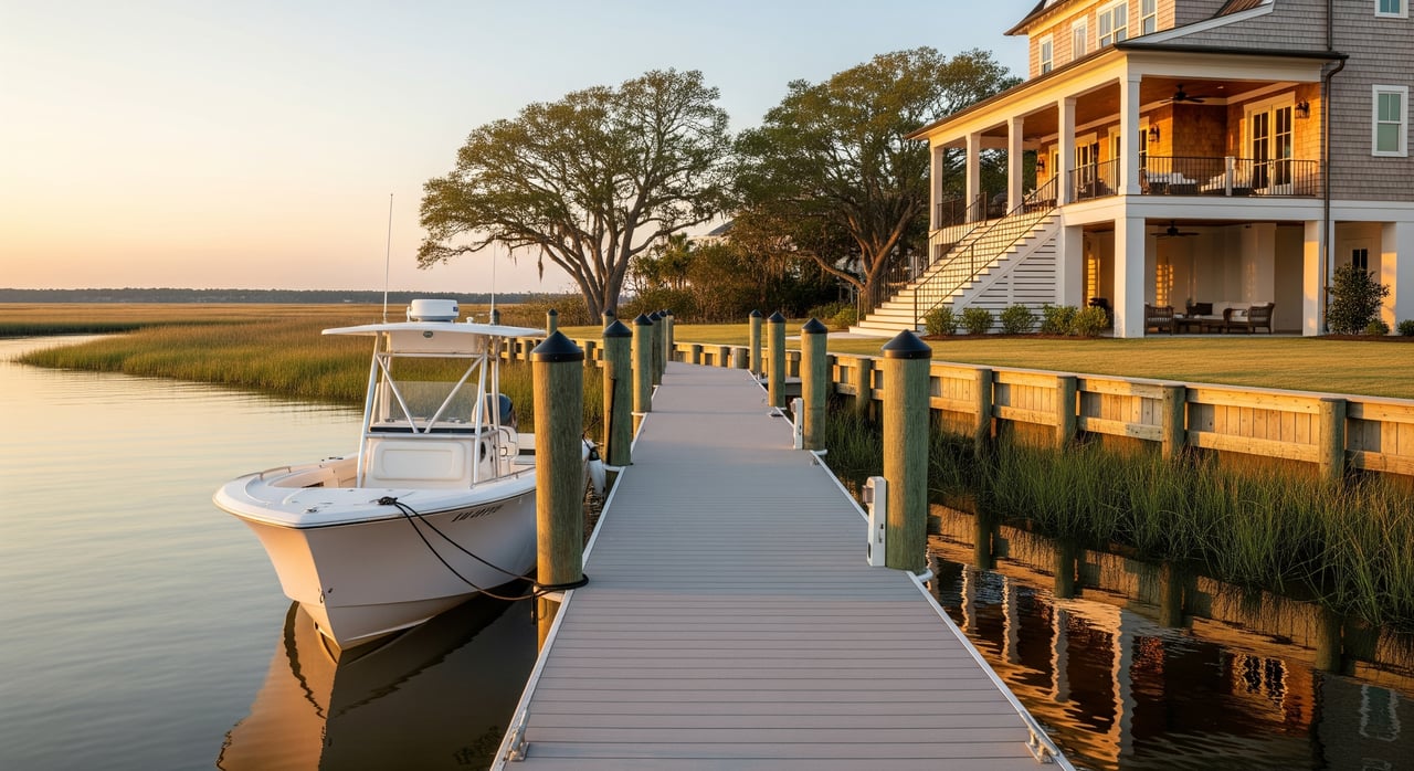
On-site checks that matter for your boat
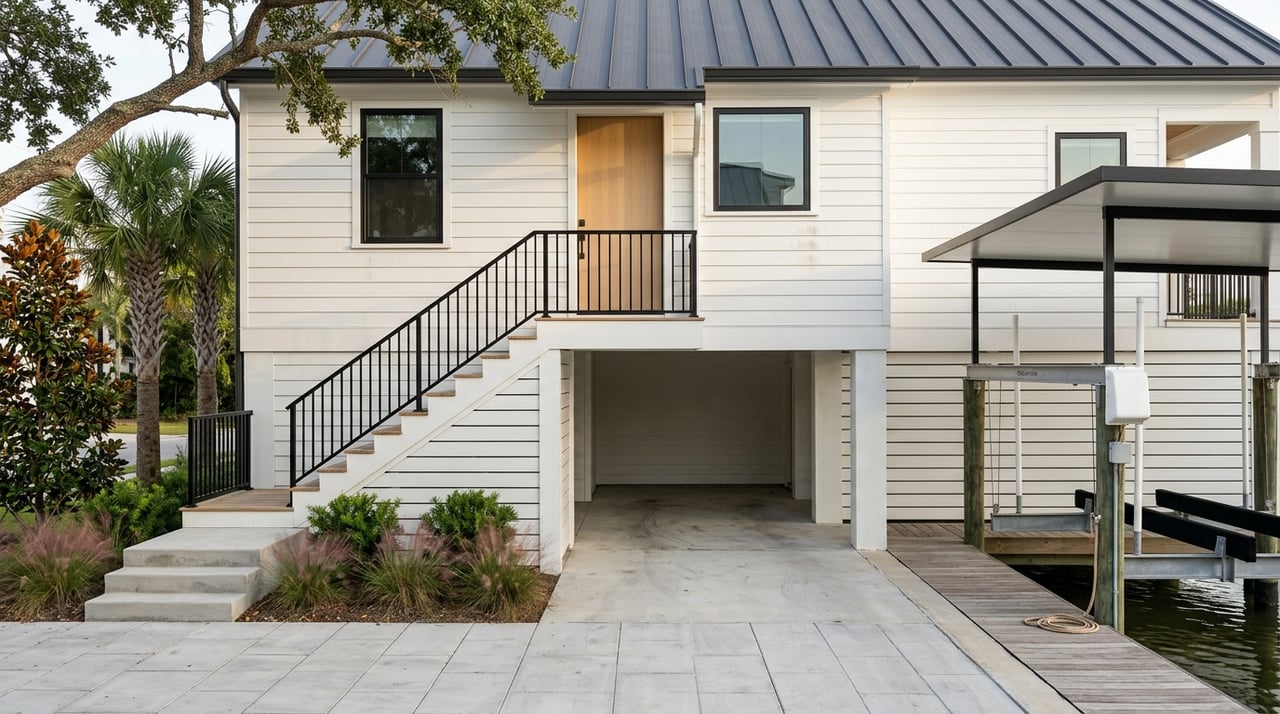
Dock and seawall condition
Start with structure and safety. Look at materials, pilings, decking, fasteners, electrical, and any boat lift.
- Check for rot, corrosion, loose or missing hardware, and marine borer damage.
- Look for signs of seawall distress like tilting, scouring, or undermining.
- Confirm electrical at the dock has proper marine-rated components and GFCI protection.
Water depth and routes
Depth and access dictate what you can run and when you can run it.
- Verify depth at mean low water at the dock and along the route to open water.
- Ask about shoaling history and whether dredging has been needed.
- Note fixed-bridge heights and any narrow channels or private cuts.
Flood risk and elevation
Most coastal properties sit in mapped FEMA flood zones. Elevation, foundation type, and base flood elevation can affect mortgage requirements and premiums. Request an elevation certificate if available.
Utilities and septic
Confirm septic location and capacity. Waterfront lots can have placement limits. If the dock has power or water, verify permits, bonding, and code compliance for marine use.
A due diligence roadmap for Elberta buyers
Use this checklist to protect your timeline and budget:
- Ask the seller and agent the right questions
- Are there permits for the dock, seawall, lift, or dredging? Can you see approval letters and dates?
- Has dredging been required, and who pays for maintenance?
- Any storm repairs, insurance claims, encroachments, or public access rights?
- Gather key documents
- Latest survey with waterline and easements
- Permit files and approval letters
- Dock maintenance records and lift manuals
- HOA or POA covenants for shared water access
- Elevation certificate and flood zone determination
- Bring in the right experts
- Licensed surveyor to confirm boundaries and riparian reach
- Marine contractor or dock inspector to assess condition and costs
- Coastal engineer if shoreline stabilization or dredging is planned
- Title professional to review deed language and easements
- Make practical site checks
- Visit at low tide to confirm usable depth and any obstructions
- Observe nearby boat traffic and wakes
- Inspect wiring, lighting, ladders, and lift operation
- Understand permits and timing
- Contact local, state, and federal offices early if you plan changes
- Expect timelines to vary based on scope and environmental review
- Budget for present and future costs
- Annual maintenance and periodic major repairs
- Potential dredging and community cost-sharing
- Flood, wind, and possible boatlift or marina-related coverage
Estimating costs and risk the smart way
Waterfront ownership can include ongoing upkeep. Plan for routine inspection and minor repairs, plus larger lifecycle items like piling or decking replacement and seawall work over time. If dredging is part of your access, treat it as a recurring line item that may involve neighbors or an association.
Insurance matters. Properties in higher-risk zones often need flood coverage separate from homeowners insurance, and coastal policies may carry wind or hurricane deductibles. Permit costs, environmental studies, and mitigation planting can add to project budgets.
Match your boat and lifestyle to the property
Start with your vessel and how you want to use it. Then match the property to those needs.
- Shallow-draft boats often fit narrow creeks with seasonal depth change.
- Cruisers and taller vessels need verified depth and fixed-bridge clearance to the ICW.
- If the home checks every box but not for your larger boat, plan on slip access at marinas in nearby towns.
- HOA rules may shape the lift, dock size, and hours of use in shared-access communities.
Work with a local team that protects you
A great water view is only the start. The right guidance helps you confirm rights, depth, permits, flood risk, and long-term costs before you close. If you want a concierge, family-first partner to help you find the right Elberta home for your boat and lifestyle, connect with the Top Tier Team. We will guide your due diligence, line up trusted local pros, and help you move from search to launch with confidence.
FAQs
Can I build a dock if I own waterfront in Elberta?
- Not automatically. Dock rights depend on deed language, riparian rights, and permit approvals from local, state, and federal agencies.
Who maintains channels near Elberta waterfront homes?
- It varies. Federal channels may be maintained by the U.S. Army Corps of Engineers, while state, county, or private channels rely on agencies, associations, or adjacent owners.
What should I know about flood insurance for Elberta waterfront property?
- Many coastal homes are in mapped flood zones where lenders require flood insurance. Expect separate flood coverage and possible wind or hurricane deductibles.
How can I confirm water depth for my boat before I buy?
- Verify depth at mean low water at the dock and along the route, check for shoaling, review any dredging history, and hire a marine contractor to sound depths.
If a storm damages a dock in Baldwin County, can it be rebuilt?
- Often with permits. Rebuilds may need updated approvals and must meet current codes and environmental rules, which can affect design and timelines.